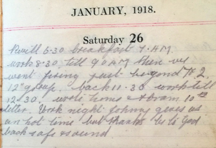
Saturday Jan 26th, 1918
Reveille 6:30. Breakfast 7am, work 8:30 till 9am then we went firing just beyond 7 & 2, 12“ group. Back 11:30, worked till 12:30. Wrote home and Abram 10th letter. Work night Johnny gives us a hot time but, thanks be to God, back safe and sound.
Ancient Lands

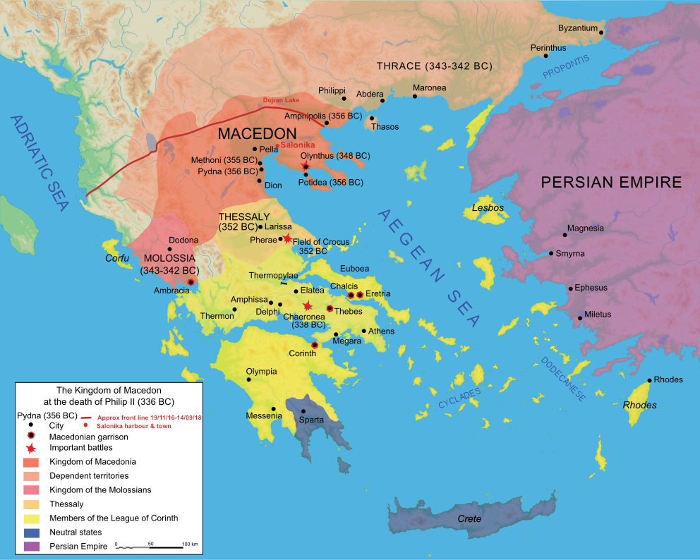
The Macedonian Front (marked on this map as a red line) cut across a land rich in ancient history. While the Front is hand drawn and therefore (very) approximate, it is interesting to note that it was largely unchanged from mid-November 1916 until the final, victorious push in September 1918.
The map itself shows the region at the end of the reign of Philip II. His son, Alexander the Great, went on to establish what was, at the time, the most powerful empire in the world. Alexander died in 323BC after which his empire was divided amongst his generals.
Cassander, one of these generals, became ruler of Macedonia from 317BC. During his reign Macedonia prospered and several cities were founded, including Thebes and Thessaloniki (Salonika). Cassander named the latter after his wife, Thessalonike of Macedon, Alexander the Great’s half sister.
Archaeology

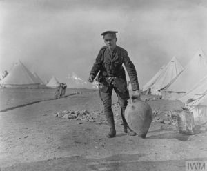
With this ancient and rich history, it is no surprise that as the Allied troops dug trenches, they unearthed many archaeological remains. This photograph shows a British Army officer carrying a Greek vase containing human ashes. It was found eight feet below the surface on a hill top while trench digging.**
The British and French were very sensitive to the unearthing of these treasures. Both took steps to make sure that they were catalogued correctly and remained the property of Greece. (See today’s Battalion diary entry.) The French were arguably best prepared: travelling with an Archaeological team as they had in the time of Napoleon. Fortuitously, Ernest Gardner, Professor of Classical Archaeology at the University of London was working as a British Naval intelligence officer in the region. He was given charge of the British finds, as this fascinating snippet of film from the British Library reveals:¹
Firing Range??
Yesterday’s Battalion diary entry mentioned that ‘A range has been chosen in Vladaja Ravine, point 1283/1809 and will be used by B & D Companies.’ In Frank’s diary entry today he talks about going ‘firing’. Looking at the Dojran Map (linked to the post for January 23rd) you will see that the chosen range is in the foothills just behind Vladaja. We cannot decipher Frank description: ‘went firing just beyond 7 ?? 2’ . Nor do we understand his reference to ‘12″ group’. Any ideas?
13th (Service) Battalion War Diary – 26th January 1918 – Vladaja Camp
GRO No 299 para 1660 dated 22-1-18 was published in orders. This refers to the automatic granting of proficiency pay to soldiers who have completed the required amount of unforfeited service. The method of procedure is also described for obtaining same. Under no circumstances are Officers allowed to keep any article of archaeological value which may be found in the area occupied by British Troops. The finding of any antiquity is to be reported to Divisional HQ through the proper channel. Appointments:- to be Acting Staff Captain 65th Inf Brigade – Temp Lieut JW Barker MC Manchester Regt (Service) Battalion, vice 2Lt (Temp Capt) CH Kinnaird, Welsh Regt (To Staff Capt 84th Infantry Brigade) dated 11-1-18.
References & further reading
* Map reproduced under GNU Free Documentation Licence
** Ancient Greek Vase. Photograph and description from Imperial War Museums
¹ The Salonika Campaign: Archaeology in the Trenches Source & copyright: the British Museum


12“ (inch) Group refers to Frank‘s results on the ranges. A „Group“ is a measurement of a person‘s consistency in hitting the target. For example if 5 rounds are fired at the target and the 2 hits furthest away from each other are 5“ apart, this is referred to as a 5“ group.
Charlie
Thanks for clarifying Frank’s comments. He writes elsewhere that he is a good shot and goes on to represent the Battalion in a competition later in the year.
Caroline